
[one_fifth]
Address:
GPS:
Telephone:
Website:
Operating Dates:
Our last visit:
[/one_fifth]
[four_fifth_last]
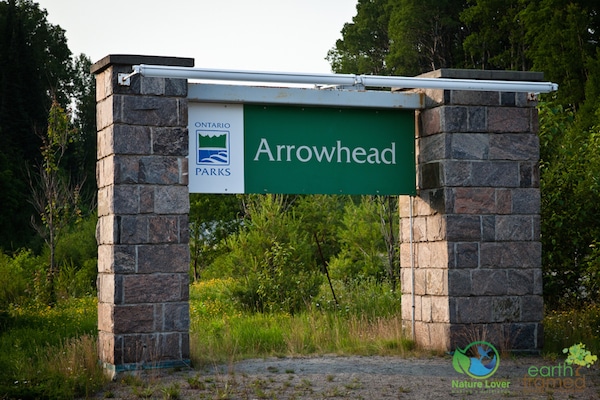
451 Arrowhead Park Road, Huntsville, ON, P1H 2J4
Latitude: 45.3915 Longitude: -79.2140
(705)-789-5105
http://www.ontarioparks.com/park/arrowhead
Camping Dates – May 8, 2015 to October 13, 2015
Winter Camping Dates – December 18, 2015 to March 29, 2016
Opening and Closing (Day Use) – May 8, 2015 to October 13, 2015 & December 18, 2015 to March 28, 2016
2015
[/four_fifth_last]
Arrowhead Provincial Park began offering camping in 1966 and became an official Provincial park in 1971. The park covers 1237 hectares in the Muskoka area, 8 kilometres north of Huntsville. There are 378 campsites – 185 of which are electrical. The park has a picnic shelter, Park Store, canoe, kayak and bicycle rentals, and a day-use area. Swimming is available at their three designated, sandy beaches. Pets have a dedicated pet exercise area and beach, as well as a swimming area near the Arrowhead Lake Bridge that they can enjoy.
What Makes The Park Special?
Arrowhead is a beautiful park with large, mature trees and nice sized campsites. The two lakes and waterways within the park area are wonderfully quiet since the park does not permit the use of motorized boats on them. There are plenty of activities to do at Arrowhead, with beautiful sandy beaches, 15 kilometres of trails, canoeing/ kayaking the lakes and rivers, as well as winter activities: skiing, snowshoeing, tubing, skating and tobogganing.
Arrowhead park is located in the gorgeous Muskoka area with beautiful scenery year round. Situated at the southern edge of the Canadian Shield, this natural wilderness offers a glimpse into our quintessential northern, rocky landscape while having a rich mixed forest containing sugar maples, yellow birch, poplar, beech, white pine, hemlock, balsam fir and white spruce.
The possibility of spotting wildlife at Arrowhead is high, due to an abundance of forest birds, common wetland birds, a variety of mammals and a fairly long list of reptiles. This means Arrowhead is a great place to experience nature.
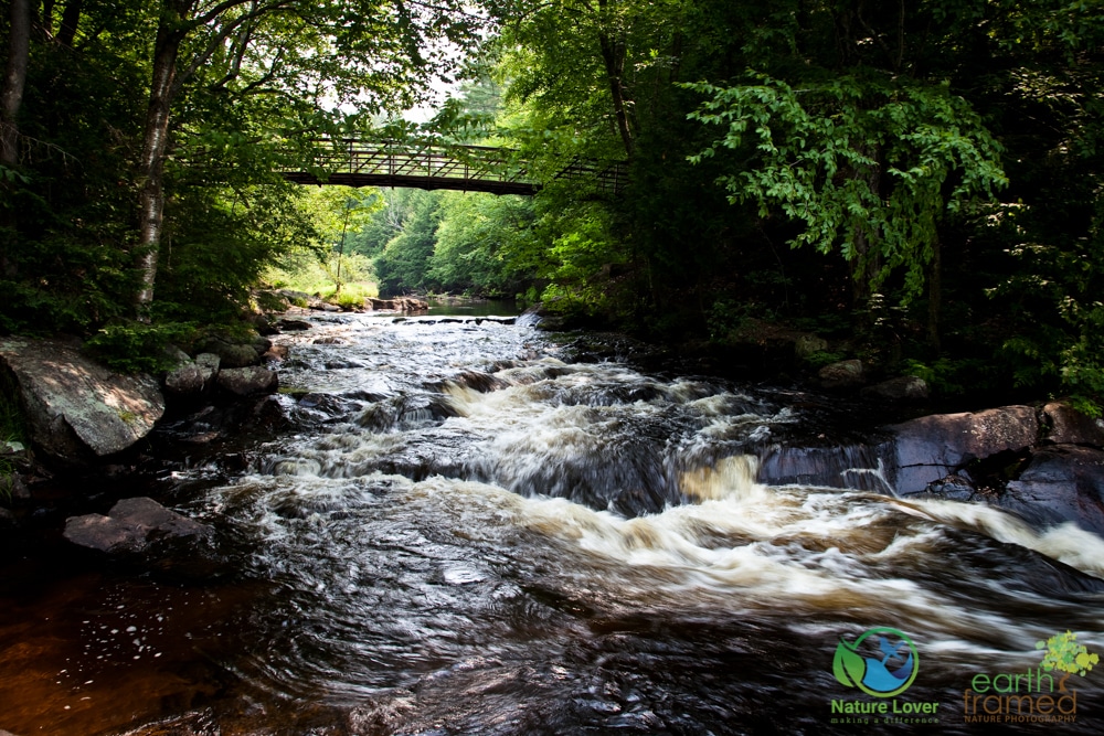
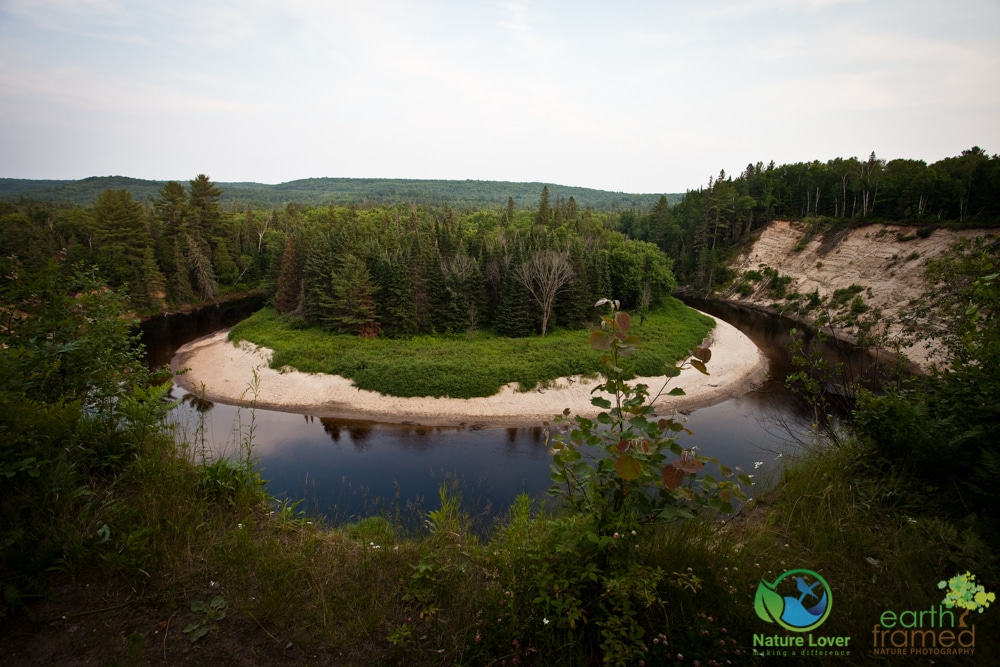
The park also boasts a magnificent cascading waterfall and an excellent view of a glacial delta that was once part of Lake Algonquin during the last ice age two million years ago.
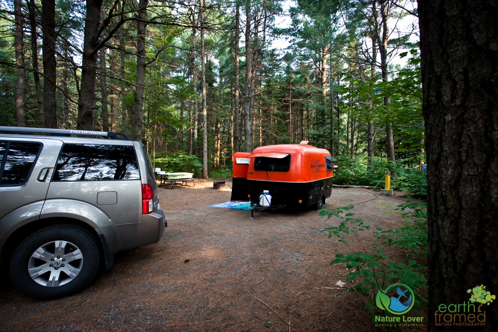
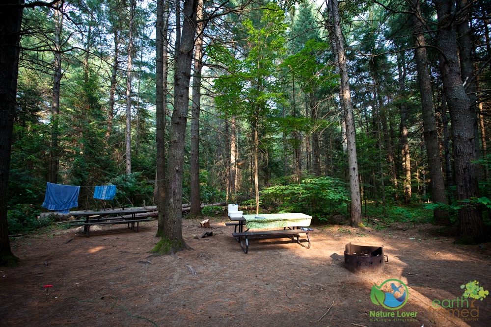
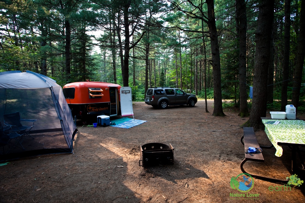
Arrowhead is a beautiful park with excellent shaded campsites and lush forests and lakes. Our site was in Roe campground and it was a fairly large, well shaded site with decent privacy. It was close enough to a flush privy with vanity and the older comfort station in the campground that was in need of an update. We did find a brand new comfort station at the East Campground, so maybe they are in the process of replacing the older facilities.
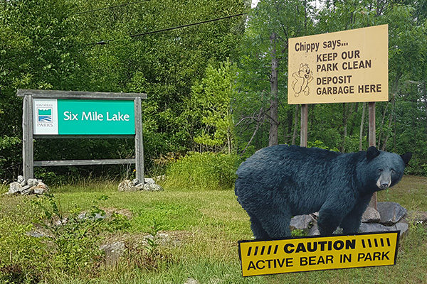
While we were setting up, a park warden was walking through the campground to warn everyone that an active bear was in the area and to make sure our campsite was ‘bear proof’. We never saw a bear while we were at the park, but heard from other campers that they had seen one around the campgrounds.
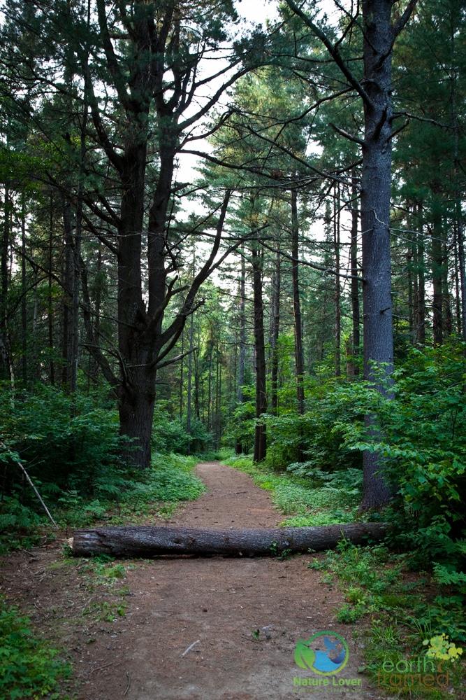
The park has 7 different trails that range from a short walk to a 5.3 km hike. We only had time to do the Stubb’s Falls Trail, the Mayflower Lake Trail and the Big Bend Lookout. The Falls trail had a variety of landscapes with a spectacular cascading waterfall. The Big Bend Lookout was a very short walk to a designated lookout that had fantastic views of the oxbow lake and the bluffs. Our last hike, the Mayflower Lake Trail, had the potential to be a pleasant trail but definitely needs some maintenance. We weren’t impressed with the part of the Mayflower trail that basically followed the hydro lines and was quite overgrown. The park is also close to Algonquin Park, if you were looking for more trails (keep in mind that your camping pass gets you into any Provincial park while you are camping).
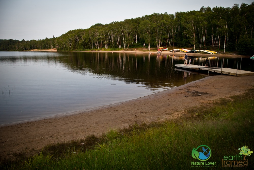
The sandy beaches were very nice and the water was very cold, but refreshing. The beach near Roe Campground is at the bottom of a sandy hill, so it is quieter than the other two beaches but a bit more difficult to get to. Many happy people were enjoying canoeing and kayaking, as well as fishing, throughout our stay.
Arrowhead has a designated pet exercise area and beach where you can have your dog off leash, as long as it is well behaved. The pet area was a long drive from our campsite. If you want to be closer to it, you will need to camp in the North Lumby Campground. In addition to the pet exercise area, pets are also allowed to swim on either side of the Arrowhead Lake Bridge (the beach area is clearly marked), but they must be leashed in this area. It is a great park for your pet since their swimming areas are also sandy and free from rocks or obstacles.
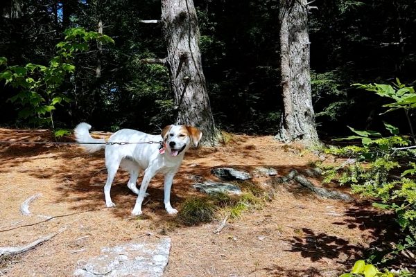
The lakes, river and wetlands are a wonderful place for spotting wildlife at Arrowhead. We saw a variety of dragonflies, butterflies and damselflies while hiking the Stubb’s Falls Trail, deer wandering throughout the forests, a large snapping turtle around the dock and the sounds of birds everywhere we went. There were also a variety of beautiful wildflowers and ferns along the various trails.
— Check out our 2015 Arrowhead Campsite: Roe Campground Site# 483 —
Arrowhead Park Map and Summer Trails
• The Mayflower Trail 2 km • Beaver Meadow Trail 4 km • The Stubb’s Falls Trail 2 km • The Homesteader Trail 3 km
• Hardwood Hill Cycling Trail 3 km • Big Bend Lookout 100 feet?
Arrowhead Park Map and Winter Trails
• Beaver Meadow Classic Trail 4.6 km • Arrowhead Lake Skate & Classic Trail 5.3 km • Lumby Skate & Classic Trail North 1 km
• Lumby Skate & Classic Trail 3 km • Homesteaders Skate Trail 2.8 km • Mayflower Lake Trail 1.5 – 2 km • Hemlock Ridge Trail 0.7 km
• Hardwood Hill Trail 3 km • Hemlock Ridge Trail 1.2 km • Stubb’s Falls Snowshoe Trail Loop 2.6 km • Sprint Trail 0.7 km
• Bunny Trail 1 km • Roe Skate & Classic Trail 2.5 km • Ice Skating Trail 1.3 km
• East River Short Loop 1.6 km • East River Classic Trail 2.7 km
Algonquin Provincial Park Trails • 18 day trails • Algonquin Park Highway 60 Overview • Interpretive Trail Maps
Huntsville Trails • The town of Huntsville has several trails that you can access from the centre of downtown • The trails range from 1.3 km to the Trans Canada Trail, which is 52 km • See a description and map of Huntsville’s trails
Muskoka Trails • Website shows trails in the Muskoka area • Find locations of trails in the Muskoka area
Biking
Canoeing
Hunting
Swimming
Birding
Fishing
Kayaking
Winter Activities
[one_third_last]
Boating
Hiking
Natural Heritage Education
Other
[/one_third_last]
Backcountry Camping
Car Camping
Electrical Sites
Group Camping
Park Store
Picnic Shelter
Visitor Centre
Barrier Free Access
Comfort Station(s)
Flush Toilets
Laundry
Pet Exercise Area
Radio Free Sites
[one_third_last]
Boat Launch
Day Use Area
French
Non-Electrical Sites
Pet Swimming Area
Rentals
[/one_third_last]
Huntsville Festival of the Arts • various classical and contemporary music events, along with dance, theatre • held in venues throughout the area • See what’s on
Huntsville Jazz Festival • Last weekend of July • Jazz in the Garden and musical acts held at the Algonquin Theatre • Check out the lineup.
Natural Heritage Education – offered once a week in the summer at the park. Check the Park Tabloid, online or the Park Store for details.
Algonquin Theatre • 37 Main Street East, Huntsville • 408 seat auditorium • Check out their upcoming shows
Beaches • 3 beaches at Arrowhead Provincial Park • Avery Beach • Camp Kitchen Beach • Hutcheson Beach • Tally Bay Beach
Muskoka Heritage Place • 88 Brunel Road, Huntsville • features 2 museums, 18 authentic pioneer buildings and an open-air train ride • No pets allowed • Admission Rates
Group of Seven Outdoor Gallery • more than 90 mural replicas throughout the Muskoka area • Find a mural by location or by artist
Provincial Parks • Algonquin (Latitude: 45.536921 Longitude: -78.265419 ), Big East River (Latitude: 45.47887843 Longitude: -79.03044277 ), J. Albert Bauer (Latitude: 45.40236487 Longitude: -79.01886423 ), Oxtongue River – Ragged Falls (Latitude: 45.40646576 Longitude: -78.8890435 )
Sugarbush Hill Maple Farm • 2389 Muskoka Road #10, Huntsville • Take a tour and try out their maple syrup products • Check their hours of operation & tour times
Sources:
(n.d.): n. pag. Arrowhead Management Plan. Ontario Ministry of Natural Resources, July. 2000. Web. 23 Sept. 2015. <http://files.ontario.ca/environment-and-energy/parks-and-protected-areas/mnr_bpp0213.pdf>.
Comment(1)
Maya the Nature Dog Explores Arrowhead Provincial Park | Nature Lover says:
October 22, 2015 at 12:07 pm[…] Maya the Nature Dog’s summer camping adventure continued at Arrowhead Provincial Park. […]