[one_fifth]
Address:
GPS:
Telephone:
Website:
Operating Dates:
Our last visit:
[/one_fifth]
[four_fifth_last]
209403 Highway 26, Blue Mountains, Ontario, L9Y 0T6
Latitude: 44.32200 Longitude: -80.20897
(705)-445-4467
http://www.ontarioparks.com/park/craigleith
Camping Dates – April 11, 2014 to October 26, 2014
Opening and Closing (Day Use) – April 11, 2014 to October 26, 2014
Early 2000’s
[/four_fifth_last]
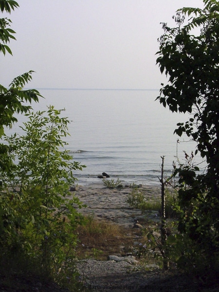
Craigleith Provincial Park was founded in 1967 and covers 66 hectares on the southern shores of Georgian Bay. There are 157 campsites – 66 of which are electrical. The park has a boat launch, picnic shelter and a day-use area. Swimming is available along the shale beach, or you can head to Wasaga Beach if you prefer sand. Pets are allowed at the designated pet exercise area and there is a pet friendly swimming area too.
What Makes The Park Special?
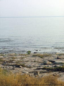
Craigleith is known for the world famous 450 million year old fossils that reside on the shale waterfront. Originating from the Ordovician period, you will find some of the oldest fossils on earth right at Craigleith! Wander the shore looking for fossils, sketching, or photographing them, but please to not remove any of the geological artifacts. Be sure to check out the sunsets and sunrises at Craigleith!

We have only stayed for a few short days, years ago, at Craigleith. The park is fairly small and narrow, so you can often hear the nearby highway even from the shore. There are a variety of campsites, some with a view of the water, some with quite a bit of privacy and others that are fairly open and less private. The condition of the sites and facitlities were quite good then and have probably been updated since we were last there.
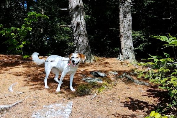
We enjoyed having a site right across from the shale beach. It made for some spectacular views and it was fantastic for our dog since she could swim frequently. There is no sand on the beach so kids can’t make sand castles, moats or even run around much. What this park does have are the fossils all over the beach. Bring a fossil book with you and introduce your family to fossil hunting (remember to never take fossils off the beach though). The park does offer a good location for a base to go sightseeing from: Northwinds Beach is within biking distance and offers a sandy beach; Wasaga Beach is close by; many waterfalls; easy access to the Bruce Trail and even Collingwood is within driving distance (15 minutes).
The Blue Mountains Trail Map • includes Bruce Trail, Georgian Trail, Kolapore Trail and Delphi Park Trail.
The Collingwood Trails Map • multi-use trail system in Collingwood with interpretive signs
Georgian Trail • located across from the park entrance • Great for hiking and biking • Runs along the highway to Meaford and Collingwood • 32 kilometres of flat, fairly smooth trail that is perfect for biking and kids.
Bruce Trail • entry points are within a 15 minute drive from the park • Trail maps and information are available at the park store.
Biking
Canoeing
Hunting
Swimming
Birding
Fishing
Kayaking
Winter Activities
[one_third_last]
Boating
Hiking
Natural Heritage Education
Other
[/one_third_last]
Backcountry Camping
Car Camping
Electrical Sites
Group Camping
Park Store
Picnic Shelter
Visitor Centre
Barrier Free Access
Comfort Station(s)
Flush Toilets
Laundry
Pet Exercise Area
Radio Free Sites
[one_third_last]
Boat Launch
Day Use Area
French
Non-Electrical Sites
Pet Swimming Area
Rentals
[/one_third_last]
Collingwood Days • End of May fun, for the whole family • bring your pet! • Event details and schedule.
Collingwood Elvis Festival • Held annually in July since 1995 • Get all the information here.
Natural Heritage Education • Offered once a week in the summer at the park • Check the Park Tabloid, online or the Park Store for details.
PupCake Dog Festival • June 13th, 2015 • Bring your family and dog to a great outdoor festival that includes a fashion show, a costume contest, a pageant and more • For more details check out their Facebook page.
Beaches • Bayview, Christie, Council, Craigleith (shale), Delphi (shale), Little River (pebble and sand), Lora Bay (sand), Memorial Park (sand), Northwinds (sand), Peasmarch (sand & stony) and Wasaga Beach (sand) • Check out ‘Visit Georgian Bay’s’ map to find each beach.
Collingwood Museum • Located at 45 St. Paul Street in Collingwood • Admission is by donation • The museum features marine, rail and First Nations exhibits and local history • Check out their website to see what’s happening.
Conservation Areas • Eugenia Falls, Feversham Gorge, Nottawasaga Bluff, Osprey Wetlands and Petun Conservation Areas are all within 30 – 45 minute drive from Craigleith.
Harbourlands Park • Located on Heritage Drive in Collingwood • Created in 2000 in memory of the shipyard workers • There are beautifully landscaped walkways and gardens around the harbour • Watch sailboats come and go throughout the day • Check out the trail map from Huronia Trails & Greenways.
Harbourview Park and Arboretum • Entrances off First Street, Hickory Street or Cedar Street in Collingwood• Wetlands, view of the bay, an Arboretum and several scenic lookouts.
Nancy Island Historic Site • Located on Mosley Street in Collingwood • Original hull of the schooner HMS Nancy which was sunk in 1814 • Replica of an early lighthouse and other special events and programs.
Nottawasaga Island Lighthouse • One of six Imperial Towers which was built in 1858 • Has seen better days and the deterioration is quite evident • Unless you have a boat you’ll have to check it out from shore though• Automated in 1959.
Provincial Parks (non-operating) • Devil’s Glen (Latitude: 44.35659846 Longitude: -80.21725061), Duncan Escarpment (Latitude: 44.41721843 Longitude: -80.46596941), Nottawasaga Lookout (Latitude: 44.40780608 Longitude: -80.2533174), and Pretty River Valley (Latitude: 44.42570626 Longitude: -80.30073792).
Scenic Caves Nature Adventure • Located at 260 Scenic Caves Road, The Blue Mountains • Spend the day exploring mountain caverns, caves and crevices • Hike above a treed valley on the longest suspension footbridge in Southern Ontario • Take the kids to the Children’s Adventure Playground • Reserve a 3 hour guided Eco Adventure Tour – includes suspension bridge, most of the caves, a treetop walk and two ziplines!